Green Valley / Atascadero Watershed

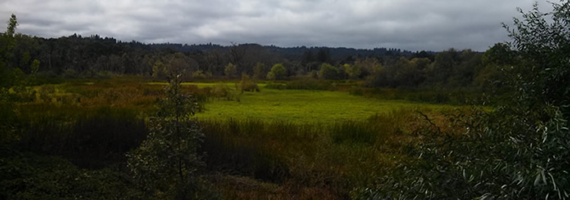
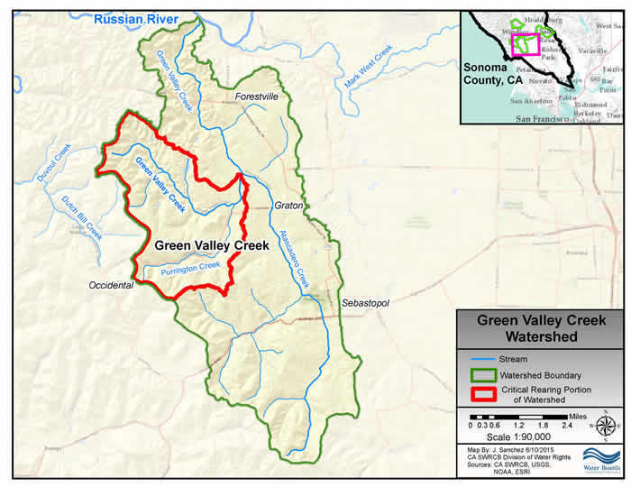
Green Valley-Atascadero Watershed is a subwatershed of the Russian River, draining 18.7 miles of blue line streams. Green Valley Creek’s headwaters lie just west of the town of Graton, and Atascadero Creek’s headwaters are just north of the town of Bodega. Atascadero flows north to the town of Graton, where it has its confluence with Green Valley Creek. At this confluence is the Atascadero marsh, home to a wide variety of water fowl, fish, reptiles and amphibians. Of these, coho salmon, steelhead trout, red legged frog and California freshwater shrimp are threatened or endangered species. The major land uses are rural residential and agricultural (vineyards, orchards and vegetables).
Natural Resource Conservation Efforts
Conservation efforts have focused on enhancing salmon habitat by removing fish passage barriers for migrating salmon and creating habitat for salmonids. Construction of off-channel winter refugia habitat and installation of large woody debris structures are both examples of habitat enhancement projects. The RCD has also worked to enhance water resources in the Green Valley-Atascadero watershed by commissioning a watershed-wide hydrological study, engaging the community on best conservation practices, and developing infrastructure for alternative water sourcing and storing. The RCD has also played a role in hosting a conversation around the flooding of Green Valley Road, and continues to explore mitigation options for this community issue. Lastly, the RCD is currently applying for funding to assess the lower reaches of Green Valley Creek for fish habitat quality.
Atascadero Creek Subwatershed Habitat Study
The Gold Ridge RCD is seeking the partnership of numerous landowners to assist in a study of the Atascadero Creek subwatershed. This creek has become the focus of our study because of its unassessed potential to provide excellent habitat for the endangered coho salmon. Learn more.
Lower Green Valley Creek Coho Habitat Study
The Gold Ridge RCD is seeking the partnership of landowners along Green Valley Creek to assist in a study of coho habitat. This study will focus on understanding habitat features within the creek corridor (such as creekside vegetation, potential fish passage barriers, stream flow connection, and wildlife presence) and identifying potential habitat enhancement opportunities. Learn more.
Watershed Resources
Upper Green Valley Creek Streamflow Improvement Plan, 2019
Water Reliability Program- Funding for Small Scale Water Storage Projects, On-Going
Upper Green Valley Fish Passage Improvement Project, 2017
Green Valley Road Flooding Mitigation and related documentation
Green Valley Creek /Dutch Bill Creek Watersheds Hydrological Community Report, 2015
Thomas Creek Ranch Off-Channel Winter Refugia Habitat Enhancement Project, 2015
Sediment Source Assessment for Upper Green Valley Creek, 2014
- The Upper Green Valley Creek Watershed Management Plan, March 2013 represents the first phase in a multi-year effort to address factors that may be limiting salmonid health in the watershed and to provide a plan of action for landowners to conserve natural resources on their property.
- Upper Green Valley Creek Watershed Management Plan Final, 2010
- Green Valley Watershed Management Plan Fact Sheet, 2009
- Purrington Creek Bank Stabilization Project Fact Sheet, 2009
- Green Valley Creek Roads Implementation Project Fact Sheet, 2008
- Jonive Creek Stream Inventory Report, 2006
- Redwood Creek Stream Inventory Report, 2006
- Sexton Creek Stream Inventory Report, 2006
- Atascadero Creek Stream Inventory Report, 1995
- Green Valley Creek Stream Inventory Report, 1995
- Purrington Creek Stream Inventory Report, 1994
Maps
Combined Dutch Bill Creek - Green Valley Creek Watershed Land Cover Map
Green Valley Creek Tables, Graphs and Map
